Seismograms for this Event
Event Info
| Region | Mindanao, Philippines |
| Time | 2005-02-05 07:23:15 -0500 |
| Magnitude | 7.1 MO, |
| Depth | 486.3 km |
| Latitude | 5.3634 |
| Longitude | 123.2288 |
| Distance | 48.95 deg |
| Azimuth | 343.934 deg |
| Back Azimuth | 153.732 deg |
Station Info
| Id | TLY |
| Name | Talaya, Russia |
| Latitude | 51.6807 |
| Longitude | 103.6438 |
| Begin Time | 1990-10-11 20:00:00 -0400 |
| End Time | 2599-12-31 18:59:59 -0500 |
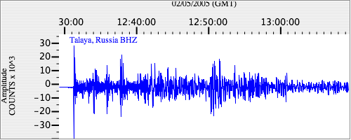
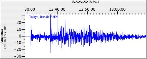
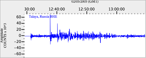
Seismograms
| II.TLY.00.BHZ 34.207066 AD 2005.02.05 12:24:21.834 GMT |
|
| II.TLY.00.BHN 25.552507 AD 2005.02.05 12:26:11.834 GMT |
|
| II.TLY.00.BHE 9.669497 AD 2005.02.05 12:21:45.434 GMT |
|