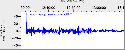
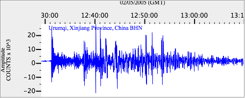
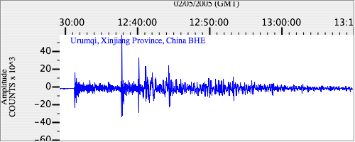
Seismograms for this Event
Event Info
| Region | Mindanao, Philippines |
| Time | 2005-02-05 07:23:15 -0500 |
| Magnitude | 7.1 MO, |
| Depth | 486.3 km |
| Latitude | 5.3634 |
| Longitude | 123.2288 |
| Distance | 49.417 deg |
| Azimuth | 326.364 deg |
| Back Azimuth | 130.364 deg |
Station Info
| Id | WMQ |
| Name | Urumqi, Xinjiang Province, China |
| Latitude | 43.8211 |
| Longitude | 87.695 |
| Begin Time | 1995-09-22 20:00:00 -0400 |
| End Time | 2599-12-31 18:59:59 -0500 |
Seismograms
| IC.WMQ.00.BHZ 8.268327 AD 2005.02.05 12:27:12.110 GMT |
|
| IC.WMQ.00.BHN 3.012363 AD 2005.02.05 12:23:34.110 GMT |
|
| IC.WMQ.00.BHE 3.430436 AD 2005.02.05 12:21:48.910 GMT |
|