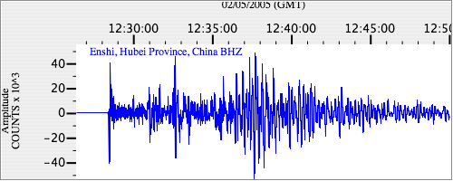
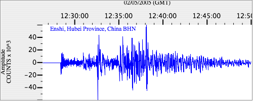
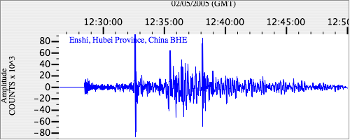
Seismograms for this Event
Event Info
| Region | Mindanao, Philippines |
| Time | 2005-02-05 07:23:15 -0500 |
| Magnitude | 7.1 MO, |
| Depth | 486.3 km |
| Latitude | 5.3634 |
| Longitude | 123.2288 |
| Distance | 27.958 deg |
| Azimuth | 334.002 deg |
| Back Azimuth | 149.702 deg |
Station Info
| Id | ENH |
| Name | Enshi, Hubei Province, China |
| Latitude | 30.2718 |
| Longitude | 109.4868 |
| Begin Time | 1997-09-19 20:00:00 -0400 |
| End Time | 2599-12-31 18:59:59 -0500 |
Seismograms
| IC.ENH.00.BHZ 10.25462 AD 2005.02.05 12:24:22.073 GMT |
|
| IC.ENH.00.BHN 5.557462 AD 2005.02.05 12:20:33.273 GMT |
|
| IC.ENH.00.BHE 2.33144 AD 2005.02.05 12:20:44.673 GMT |
|