Seismograms for this Event
Event Info
| Region | Off W Coast Of Northern Sumatra |
| Time | 2004-12-25 19:58:50 -0500 |
| Magnitude | 8.5 MS, |
| Depth | 10.0 km |
| Latitude | 3.2977 |
| Longitude | 95.7785 |
| Distance | 65.171 deg |
| Azimuth | 101.898 deg |
| Back Azimuth | 278.057 deg |
Station Info
| Id | HNR |
| Name | Honiara, Solomon Islands |
| Latitude | -9.4322 |
| Longitude | 159.9471 |
| Begin Time | 1998-03-08 22:50:00 -0500 |
| End Time | 2599-12-31 18:59:59 -0500 |
Seismograms
| IU.HNR.00.BHZ 16.564684 AD 2004.12.26 01:00:45.373 GMT |
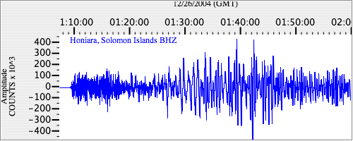
|
| IU.HNR.00.BH1 5.7234793 AD 2004.12.26 01:00:32.373 GMT |
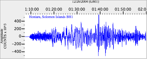
|
| IU.HNR.00.BH2 2.6424606 AD 2004.12.26 01:01:51.473 GMT |
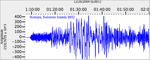
|