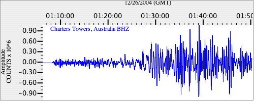
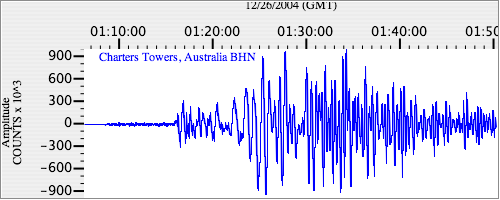
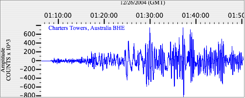
Seismograms for this Event
Event Info
| Region | Off W Coast Of Northern Sumatra |
| Time | 2004-12-25 19:58:50 -0500 |
| Magnitude | 8.5 MS, |
| Depth | 10.0 km |
| Latitude | 3.2977 |
| Longitude | 95.7785 |
| Distance | 54.713 deg |
| Azimuth | 117.353 deg |
| Back Azimuth | 289.363 deg |
Station Info
| Id | CTAO |
| Name | Charters Towers, Australia |
| Latitude | -20.0882 |
| Longitude | 146.2545 |
| Begin Time | 1998-10-06 17:00:00 -0400 |
| End Time | 2599-12-31 18:59:59 -0500 |
Seismograms
| IU.CTAO.00.BHZ 40.67505 AD 2004.12.26 01:00:28.961 GMT |
|
| IU.CTAO.00.BHN 9.144304 AD 2004.12.26 00:58:10.061 GMT |
|
| IU.CTAO.00.BHE 26.857164 AD 2004.12.26 00:54:47.761 GMT |
|