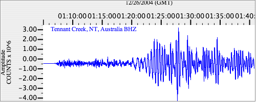
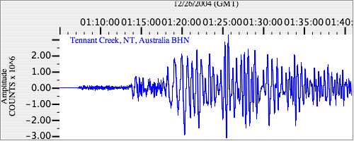
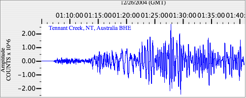
Seismograms for this Event
Event Info
| Region | Off W Coast Of Northern Sumatra |
| Time | 2004-12-25 19:58:50 -0500 |
| Magnitude | 8.5 MS, |
| Depth | 10.0 km |
| Latitude | 3.2977 |
| Longitude | 95.7785 |
| Distance | 44.366 deg |
| Azimuth | 122.956 deg |
| Back Azimuth | 297.075 deg |
Station Info
| Id | WRAB |
| Name | Tennant Creek, NT, Australia |
| Latitude | -19.9336 |
| Longitude | 134.36 |
| Begin Time | 1994-03-26 19:00:00 -0500 |
| End Time | 2599-12-31 18:59:59 -0500 |
Seismograms
| II.WRAB.00.BHZ 34.639675 AD 2004.12.26 00:58:43.650 GMT |
|
| II.WRAB.00.BHN 15.030183 AD 2004.12.26 00:58:43.650 GMT |
|
| II.WRAB.00.BHE 29.2856 AD 2004.12.26 00:58:43.650 GMT |
|