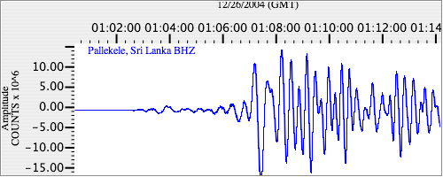
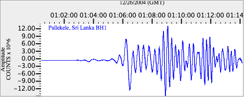
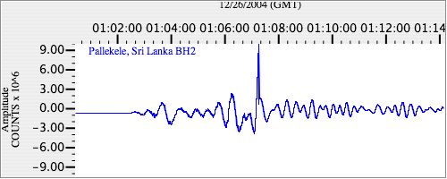
Seismograms for this Event
Event Info
| Region | Off W Coast Of Northern Sumatra |
| Time | 2004-12-25 19:58:50 -0500 |
| Magnitude | 8.5 MS, |
| Depth | 10.0 km |
| Latitude | 3.2977 |
| Longitude | 95.7785 |
| Distance | 15.52 deg |
| Azimuth | 285.347 deg |
| Back Azimuth | 103.959 deg |
Station Info
| Id | PALK |
| Name | Pallekele, Sri Lanka |
| Latitude | 7.2728 |
| Longitude | 80.7022 |
| Begin Time | 2000-08-21 20:00:00 -0400 |
| End Time | 2599-12-31 18:59:59 -0500 |
Seismograms
| II.PALK.00.BHZ 7.2741513 AD 2004.12.26 00:56:52.978 GMT |
|
| II.PALK.00.BH1 2.6245592 AD 2004.12.26 00:57:00.178 GMT |
|
| II.PALK.00.BH2 10.551265 AD 2004.12.26 00:57:00.178 GMT |
|